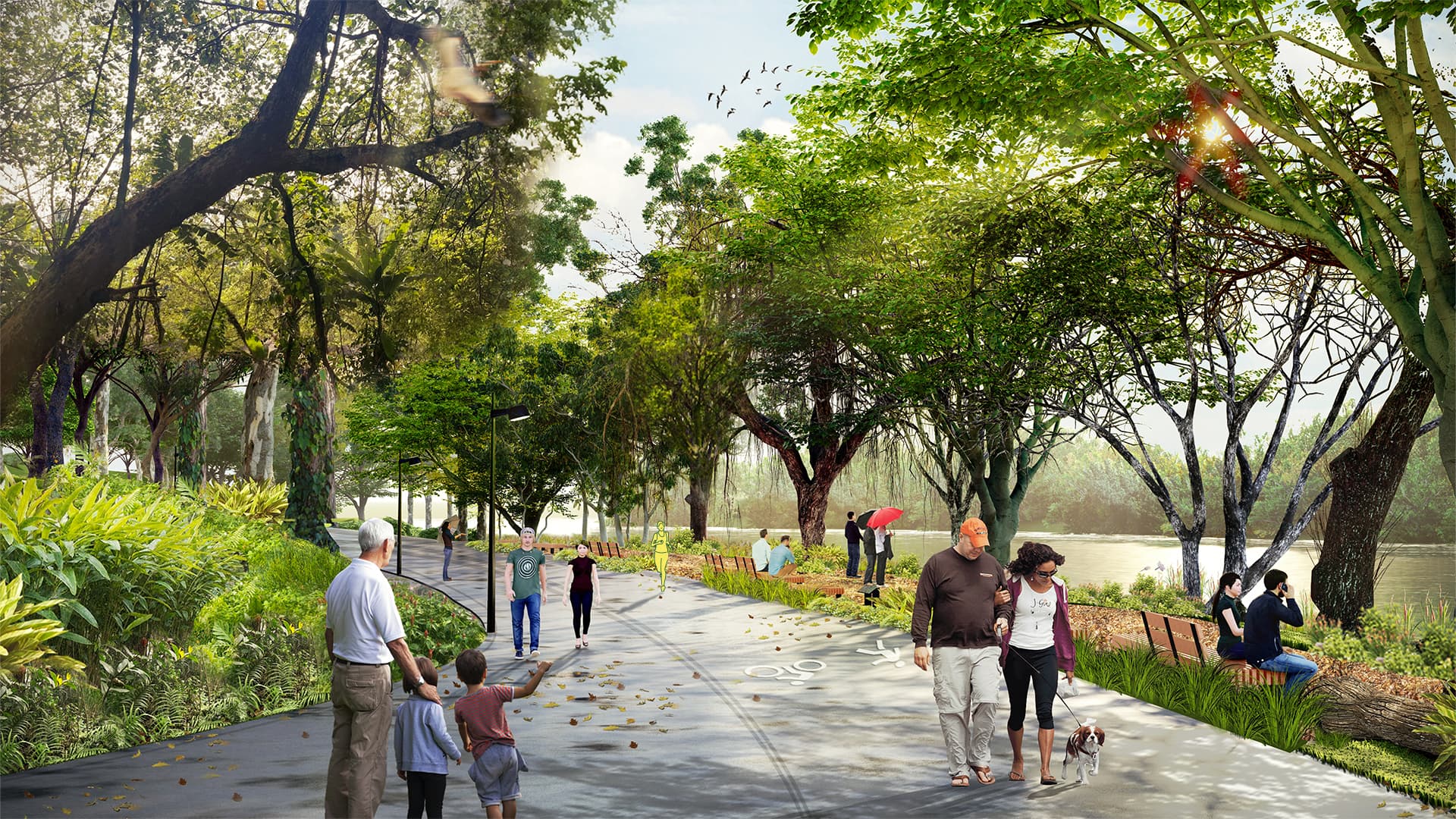
Nava Park Green Belt envisions a slope-sensitive promenade along the Cisadane River. Following natural contours, it preserves trees, restores stability, and introduces distinct walking zones. The design transforms inaccessible terrain into connective civic infrastructure, balancing ecological care with everyday use and framing a resilient riverside experience for BSD.
Landscape vision that connects people to water through careful calibration of topography, nature, and movement
Once hidden behind dense vegetation and steep slopes, the riverside site revealed both challenge and opportunity, a place where movement could follow nature rather than oppose it. The landscape vision connects people to water through careful calibration of topography, vegetation, and access. With elevations from +12 to +30 meters, every contour becomes part of a living green spine that links urban fabric to natural riverbanks.

Though rich in natural vegetation, the site’s steep slopes, visible erosion, and fragile soil conditions posed constraints on both stability and accessibility
Steep gradients, loose soil, and visible erosion made access difficult and construction risky. Slopes exceeding 100 percent required careful intervention to hold both structure and habitat in balance. By integrating circulation and public space while retaining habitat integrity, stabilization terraces, permeable paths, and vegetated embankments transform constraint into continuity, allowing people to walk beside the river without breaking its flow.

The landscape is designed as a continuous, shared promenade, stitched into the hillside without large-scale cutting or infill, and shaped around nature rather than imposed upon it
The design organizes the riverside into a continuous park system that threads through the development, binding built edge and riparian forest. Trails follow natural contours; viewing decks hover just above flood lines; bioswales capture and filter surface water before it meets the stream. Each intervention is measured with minimal cut, maximum connection, creating a landscape where structure yields to soil and water. What was once inaccessible now becomes an unfolding terrain of movement, light, and restoration.